CBRN Masks · Preparedness tools
Nuclear Power Plant Near Me
Find the nuclear power plants and research reactors closest to your home, see which emergency planning zone you live in and how quickly a release could reach you with today’s wind.
Explore. Understand. Prepare.Free tools for your own location.
How to use it
- 1
Enter where you liveSearch your town or postcode, click the map or use your location. The five nearest reactor sites appear in the list: power plants (round markers) and research reactors (diamonds).
- 2
Check your zoneThe rings show the emergency planning zones of the selected site. The cards show your distance, your zone and the direction of the site. Use the filters to add shut-down plants and reactors under construction.
- 3
Simulate a releaseUse today’s weather or set wind and sky yourself, then press play. The purple path shows how a cloud would travel and widen over 24 hours.
A release travels with the wind, not with borders.
Many people in Europe live within 100 km of a nuclear power plant, often in a neighboring country. After Chernobyl in 1986, radioactive fallout reached Germany and much of Europe within days.
Emergency planning zones show where the authorities prepare protective measures such as sheltering, iodine tablets and evacuation. Beyond them, a plume can still pass overhead when the wind blows toward you.
Not every reactor is a power plant. Universities and research centers run research reactors, from training reactors of less than a watt to materials-testing reactors of 100 megawatts. They hold far less radioactive material than a power plant, so their planning zones are small or stay on the site, but they are part of what is near you.
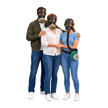
The most important protection is to go indoors and follow official alerts. When you have to go outside or leave the area, a gas mask with a particle filter reduces the radioactive particles you breathe in.
Nuclear reactors by country (status October 2026)
Reactor units counted from the simulator’s data. “In operation” leaves out units that are idle or offline, such as the Zaporizhzhia units in Ukraine.
| Country | Power reactors in operation | Under construction | Shut down | Research reactors in operation |
|---|
| United States | 94 | 1 | 40 | 35 |
|---|
| Canada | 17 | 1 | 8 | 4 |
|---|
| United Kingdom | 9 | 2 | 36 | 1 |
|---|
| France | 57 | 0 | 14 | 2 |
|---|
| Germany | 0 | 0 | 36 | 5 |
|---|
| Belgium | 2 | 0 | 6 | 3 |
|---|
| Netherlands | 1 | 0 | 1 | 2 |
|---|
| Switzerland | 4 | 0 | 2 | 1 |
|---|
| Austria | 0 | 0 | 0 | 1 |
|---|
| Czechia | 6 | 0 | 0 | 3 |
|---|
| Slovakia | 6 | 0 | 3 | 0 |
|---|
| Hungary | 4 | 1 | 0 | 2 |
|---|
| Poland | 0 | 0 | 0 | 1 |
|---|
| Sweden | 6 | 0 | 7 | 0 |
|---|
| Finland | 5 | 0 | 0 | 0 |
|---|
| Spain | 7 | 0 | 3 | 0 |
|---|
| Ukraine | 9 | 2 | 4 | 3 |
|---|
| World | 412 | 59 | 223 | 190 |
|---|
Power reactors: IAEA PRIS data via GeoNuclearData with verified updates to 26 October 2026; Ukraine also has six Zaporizhzhia units in cold shutdown, and the US Palisades plant is being restarted. Research reactors: IAEA Research Reactor Database. Shut-down counts include reactors being decommissioned.
Questions and answers
Which reactors are included?
All nuclear power plants in the world with the status of each reactor unit (in operation, not producing power, under construction or shut down) and 216 research reactors in 54 countries, 190 of them in operation. Power reactors come from the open GeoNuclearData database, which mirrors the IAEA’s PRIS database, updated with verified changes up to October 2026, such as the shutdowns of Doel 1, Doel 2 and Tihange 1, the start-up of Mochovce 4 and the restart of Kashiwazaki-Kariwa 6. Research reactors come from the IAEA Research Reactor Database, with statuses checked for this release.
How far from a nuclear power plant is safe?
There is no single safe distance. Authorities plan the most urgent measures close to a plant (in Germany: evacuation within 5 km, sheltering and iodine tablets within 20 km), but the wind can carry radioactive material much further: after Chernobyl in 1986, fallout reached Germany within days. What matters is knowing your zone, following official alerts and being ready to shelter and protect your airways.
What are emergency planning zones?
Areas around a reactor where authorities prepare protective measures in advance. Germany uses zones of 5, 20 and 100 km around operating plants (smaller around shut-down ones); France and Belgium plan within 20 km; the US uses 10 and 50 miles. Where no national rule is stored, the simulator shows the international sizes recommended by the IAEA (5, 30 and 100 km). For research reactors the IAEA suggests much smaller zones: about 0.5 km at 2–10 MW, up to 5 km at 10–100 MW and up to 25 km above 100 MW.
What is a research reactor?
A nuclear reactor used for research, teaching, medical isotopes or materials testing rather than for electricity. Most are small: many university reactors run at a few hundred kilowatts or less, while a large power reactor produces around 3,000 megawatts of heat. A few research reactors, such as BR2 in Belgium and HFR in the Netherlands, are larger and supply isotopes for hospitals worldwide.
How far can radioactive material travel?
As far as the wind carries it. At 15 km/h a cloud covers 100 km in under 7 hours. The simulator shows the path and width for constant wind; real clouds change direction, and rain can wash material out locally.
Should I take iodine tablets?
Only when the authorities tell you to. Iodine tablets protect only the thyroid gland against radioactive iodine and are not suitable for everyone. They do not protect against other radioactive substances.
Does a gas mask help in a reactor accident?
Yes, against the particles you would otherwise breathe in. A tight-fitting full-face mask with a particle filter keeps radioactive dust out of your lungs while you are outdoors or evacuating. The most important protection is still to stay indoors and follow official alerts.
Is the release path a forecast?
No. It is a standard Gaussian spread for constant wind and weather, meant to show direction, timing and width. Real forecasts in an emergency come from the national radiation protection agencies.
How the model works · assumptions & sources
Power reactors: GeoNuclearData 0.17.17 (ODbL 1.0, from the IAEA PRIS database), grouped into sites, with status changes verified to 26 October 2026 against operator, regulator and IAEA announcements (for example Doel 1, Doel 2 and Tihange 1 shut down in 2025; Flamanville 3 and Mochovce 4 connected to the grid; Kursk II-1 in operation, Kursk 2 and Bilibino shut down; Kashiwazaki-Kariwa 6 restarted; Kori 3 and 4 and Hanbit 1 and 2 offline pending licence renewal; Zaporizhzhia occupied, units in cold shutdown; new construction at Paks II, Darlington, Leningrad II and Kemmerer). Research reactors: entries of the IAEA Research Reactor Database as compiled in Wikipedia’s list of research reactors, limited to reactors in operation, out of service or under construction, and corrected where operators or regulators reported changes (for example ISIS Saclay and KUR Kumatori closed, the NIST reactor restarted in 2026, FRM II out of service since 2020); subcritical assemblies, naval prototypes and military production reactors are not included. Each site’s location is marked as reactor, institute or town level. Planning zones: Germany 5/20/100 km around operating plants and about 2/10/25 km around shut-down plants that still hold fuel (SSK 2014); France PPI 20 km (ASN 2019); Belgium 20 km; Sweden about 5/25/100 km; United States 10/50 miles (NRC); other power plants IAEA reference sizes PAZ 5 km, UPZ 30 km, EPD 100 km (IAEA 2013). Research reactors: IAEA EPR-METHOD (2003) zones by thermal power, upper values: 0.5 km (2–10 MW), 5 km (10–100 MW), 3 km precautionary and 25 km urgent-action zone (above 100 MW); none off site at 2 MW or less. Release path: continuous release moving at wind speed; crosswind spread from Briggs (1973) open-country σy with Pasquill stability from wind and sky; outer band ±2σy (about 95%), core ±1σy; arrival time = downwind distance ÷ wind speed. Optional current weather: wind, cloud cover and sun height for the hour at the selected site from MET Norway Locationforecast 2.0 (CC BY 4.0); a clear sky with the sun above 15° counts as a sunny day, a clear sky after sunset as a clear night, everything else as overcast. No dose, deposition, terrain or rain is calculated. Historical rings: Chernobyl exclusion zone 30 km (1986), Fukushima evacuation zone 20 km (2011).
Maps: VersaTiles, © OpenStreetMap contributors. Places and postcodes: GeoNames (CC BY 4.0). Reactor data: GeoNuclearData (ODbL 1.0, from IAEA PRIS) and the IAEA research reactor database as compiled by Wikipedia (CC BY-SA 4.0), status updated to October 2026. Current weather on request: MET Norway (CC BY 4.0). Without location permission, the starting area is estimated from the country the store detects and your browser’s time zone. City search runs in your browser; your exact location is used only with your permission and stays in this browser tab. “Use current local weather” sends the coordinates of the scenario point to MET Norway. Map tile requests reveal the viewed map area to the map provider.